Showing posts with label presidential range. Show all posts

Wednesday, July 13, 2011

Trip Review: Mt Washington

Now that my legs have recovered I can review our weekend trip to the highest peak in the Northeast...home to some pretty crazy weather...as we certainly encountered first hand...Everyone jokes about being prepared for the hike up Mt Wash...but it isn't an exaggeration...you need to be smart and prepare for the drastic weather changes...if you do that...the hike will be a success with positive memories and some amazing pictures!

Trip Overview:
Start: Pinkham Notch Visitors Center
Up: Tuckerman Ravine Trail
Down: Tuckerman to Lion Head to Tuckerman
Camp: Hermit Lake Shelters
Miles: 8.3
Time: 1-2 day hike

Route to the summit:
We started out at the Pinkham Notch Visitor Center 10 miles south of Gorham, NH and fueled up with a huge buffet style breakfast at the Joe Dodge Lodge...always my biggest advice for hiking and any athletic endeavor is to make sure you are fueled up with lots of calories...we certainly did that and supported the AMC while at it...not a bad start...We purchased tickets to camp at the bottom of the Ravine at the Hermit Lake Shelters and headed on our way by 8am...The first 2.4 miles up to Hermit Lake were rocky and a fairly steady climb...you certainly realize what you are in for quite quickly...however I was in pretty good shape after our last few weekends of tough hiking so I was excited to get to our tent site and continue up the headwall...We made it to the caretakers cabin and our home for the night...we checked in, set up the tent and lightened our pack for the trip to the summit...It felt great to lighten the load and made for a stronger and safer hike to the observatory.  The view at the cabin was amazing as it opened up leaving us with a visual of the headwall and bowl...amazing views!


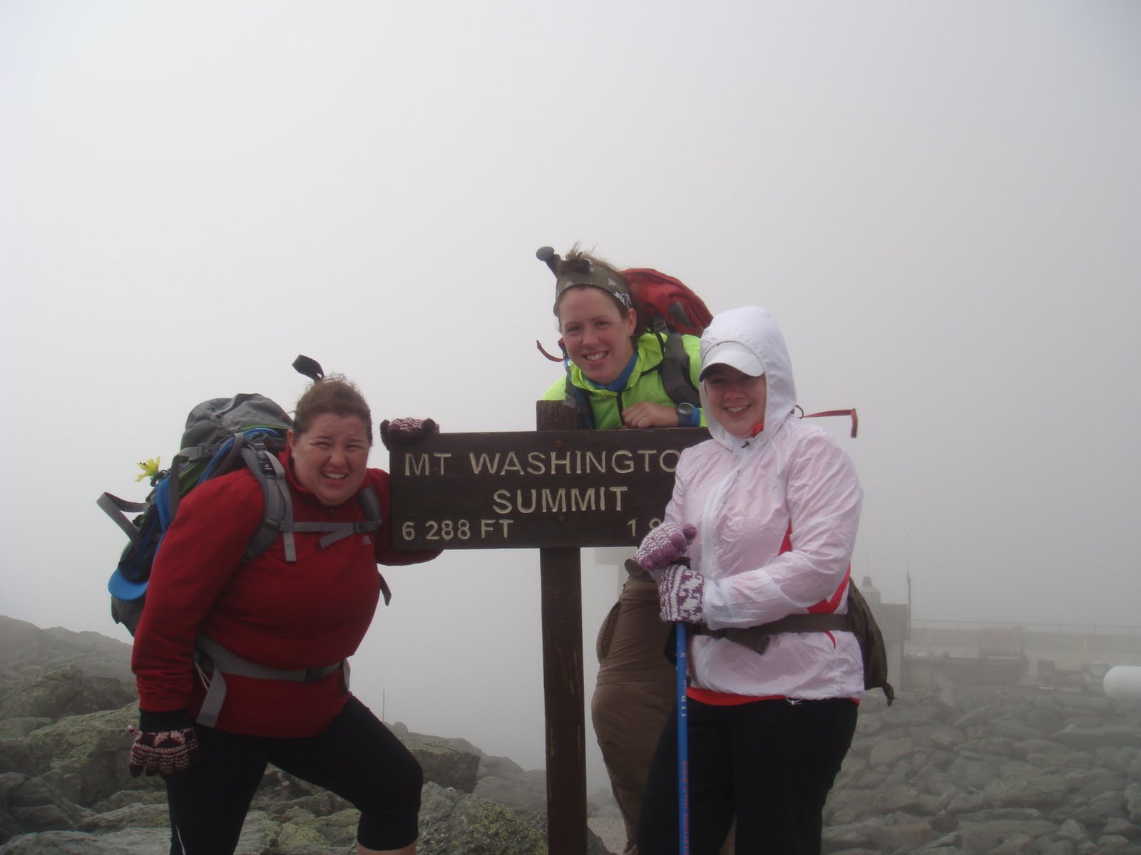
This is also where we began to see the weather change...we started off with clear skies and temps in the 80s...we begin to see clouds move in here and as we head up the headwall the weather worsened the higher we climbed...you will see this progression via the pictures with the summit at almost zero visibility. 

We headed up toward the headwall where some tough hiking began: "Beyond Hermit Lake, the Tuckerman Ravine Trail changes in its character – it becomes much narrower, and has several quite steep sections. It ascends along the "Little Headwall" to the "Connection", and then travels into the "Floor" of the Ravine. The steepest and roughest part of the climb comes next, ascending the "Headwall" of the Ravine. This is an area that is typically wet, and extra caution is needed to avoid slipping. While thousands travel this trail each year without incident, the trail ascends a cliff, and travel off the Trail would bring you over a precipice with disastrous results"  This was made more difficult as the temperature dropped and wind increased with storms rolling in...the highlight of this portion of the trail was the remaining snow that we hiked within feet of about halfway up the headwall.


We successfully ascended the headwall and started the last push to the summit...At this point the trail becomes less steep but is made up entirely of rough boulders, known as the summit cone....typically a tough climb, but made worse with our horrible weather.  Wind gusts reached 70 mph, visibility was limited, and the temperatures dropped dramatically.  At this point we added layers with fleece and rain jackets, and I was left wishing I packed my gloves and winter hat, something I will certainly remember for the next trek above treeline!


Route to Camp:
We asked for advice at the observatory for our trek down.  It took us a good amount of time to reach the summit; arriving at around 230pm...We were told that they never recommend descending via Tuckerman as the headwall leaves you exposed to the elements with great risk of heading off the edge of the trail...considering the weather we took the advice and used Lion Head Trail to reach the Hermit Lake Shelters for the evening.  We were fortunate; the weather started to clear leaving us with some fantastic views of the headwall and Ravine that we just climbed...I always support a loop hike so you hike new terrain, views and areas of the mountain...so I was excited about the route and the spectacular views!   The trail also left us with some challenging scrambling and my first ladder to help assist the descent down...It was a slow hike down with us arriving at camp around 730pm tired and excited for a jetboil dinner!


I recommend a night at the Hermit Lake Shelters...The tent platforms are in excellent shape, with a solid wood floor above the ground...there is a caretakers cabin, toilets, clean water, and a bear rope already set up for easy bear safety.  They have weather updates every am, so you can check the forecast before heading up towards the summit.  It is gorgeous with a natural mountain lake and a few trails around it for a relaxing evening walk if you are up to it after a long day...we were not!  You can't reserve a spot ahead, so make sure to get your tickets first thing at Pinkham Notch!


We had a relaxing night and morning with only 2.4 miles to descend to get back to the visitors center and our car.  We filled up our water for safety and headed down the remaining few miles down Tuckerman.  We stopped for several pictures and checked in with several hikers on their way to the summit...We made it down in just under 2 hours...headed to the car...and straight for some burgers in Gorham!!!


Few things for next trip:
-The weather really is harsh and unpredictable, so pack fleece, rain gear, gloves, and hats...EVEN IN JULY OR AUGUST!
-Take the safe route down...Lion Head Trail has gorgeous views and is safer especially in bad weather or late in the day.
-Start early...the hike took longer than we anticipated and we were down to minutes before dark hit at the end of the day.
-Invest in some good trekking poles...again they were clutch especially on the hike down!

Hope this summary was helpful for you...feel free to comment with your own experiences on Mount Washington or the Presidential Range... 

THIS ASS CLIMBED MOUNT WASHINGTON!

Tuesday, July 5, 2011

Northern Presidentials Humble: Lessons Learned

We started out on our first true backpacking trip above treeline into an alpine zone...NH is unique in that most of the presidential range is above treeline: Perhaps the Range's most remarkable feature is its extensive area above treeline, the greatest contiguous alpine area in the United States east of the Mississippi. Treeline here, which averages about 4,500 feet, is significantly lower than in mountains in the west, thanks to the extreme climatic conditions, including cold temperatures, high winds, and frequent atmospheric icing. 

Our goal was to summit both Madison and Adams, camping out a mile below the summit at Valley Way Tentsite...The hike up was tough and with a late start we didn't get above treeline on day 1, deciding to set up camp and rest up for a big day Sunday.  We planned to bag the 2 most northern summits of the Presidential range, including Mt. Adams the 2nd tallest peak...well we started our hike early on day 2 and were met with steady rain and thunderstorms...the alpine zone is not somewhere you want to be during a thunderstorm...


So we compromised and decided to head up to the Alpine zone and check in at the AMC Madison Hut and make a decision at that point...We got up to the hut and were met with heavy rain and winds as we sat between both Madison and Adams...We dried off and fueled up but decided given our experience the best thing to do was head back...We did take the Airline trail which kept us above treeline for about a mile as we headed down the ridge above Kings Ravine...The trek down made us realize we made a smart decision as it may have been the longest 4 miles of my life...The trail was made more difficult with the rain providing little to no traction and some scary moments including my first hiking fall and injury. 

Instead of more details on our route and our experience I feel you would get more out of what I learned on this trip...so below check out the top 5 lessons learned from our first trek above NH treeline:

1. Know your Experience- We knew we had little hiking experience, especially experience above treeline, so we listened to the advice of the experts and stayed off the summit where the weather would leave us exposed and vulnerable.  It was tough being so close to the summits and not bagging them, but getting home safe was more important...Be Adventurous, but be smart and know your limits!

2. Pack Light- I have said this before and thought I learned my lesson, but with 3-4 miles of vertical hiking I truly learned the importance of a light pack.  Pack smart and safe, but knowing what to leave behind is the key to a more enjoyable hike.  AMC has huts above the treeline throughout the Presidential range so you can trek without a heavy tent; I would certainly consider this for the next hike.  They fill up fast and reservations are required so plan ahead.

3. Pack the Sticks- We were smart enough to pack one set of poles we had from skiing/snowshoeing...and I don't think we would have made it down without them given the wet conditions.  We will both carry our own next hike without a doubt.  We ended up sharing a set this hike and it gave us enough balance and sense of security to safely make it back.  I always thought these were just one of those "extra" accessories, a way for the industry to make more money...I was wrong... and will never go without again!

4. These Boots are Made for Walking- I have been hiking in the Brooks Cascadia, a solid trail running shoe, but after the Greylock hike and rolling my ankle a few times I felt I needed to invest in some solid boots.  GOOD CALL...I grabbed the Asolo Fugitive GTX Hiking Boots(review to come in the next few weeks), and much like the hiking poles...I would not have made it without them...Certain things you can skimp on and try to save some cash, but so much of the gear you invest in for hiking will help keep you safe, and may even  save your life.  Don't skimp on the boots!


5. Don't Leave your Rain Gear at home- We checked the forecast and figured we could get away with our lightweight Brooks running jackets- water resistant and lightweight, but certainly not waterproof...Weather said chance of thunderstorms, so we packed as light as possible and skimped on the rain gear...bad choice that we will not make again...ALWAYS pack the rain gear, especially if you are heading above treeline.  The weather up there is unpredictable...and it can be clear in the valley but rainy at the summit.  Staying dry is so important when you are exposed on the summit with no protection from the elements.  Hypothermia is one of the leading causes of death and injury on the Presidential Range...Pack a good solid rain jacket and pants, and don't leave the pack cover behind either...If you get stuck on the mountain, you need everything in your bag DRY...something we also failed to do...Don't leave the rain protection behind with hopes of saving weight in your pack...Staying dry means staying warm!

Take our advice and be prepared, even in the smaller New England mountains.  The weather is unpredictable and harsh...and you need to pack with survival in mind...whether it is winter or the dog days of summer... 
BE SMART...BE SAFE...BE ADVENTUROUS!

Above Treeline

Airline Trail on Mt Adams